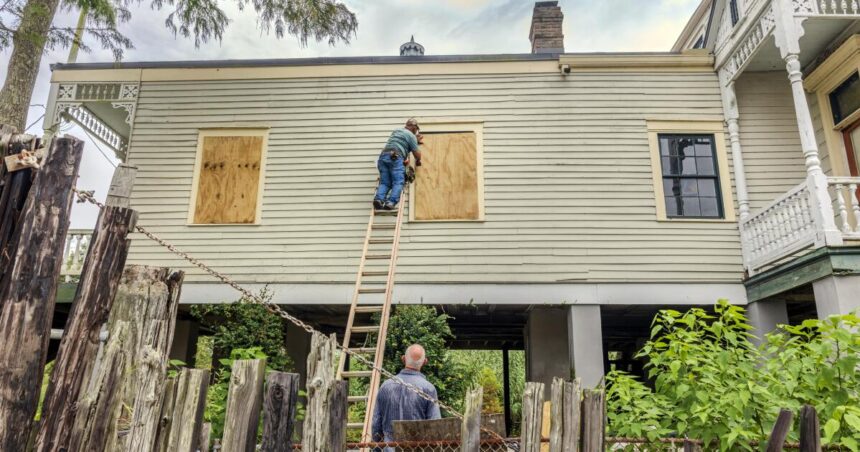
Tropical Storm Francine was swirling and strengthening in the extremely warm waters of the Gulf of Mexico and was expected to reach hurricane strength on Tuesday and make landfall in Louisiana on Wednesday.
Hurricane warnings were in effect along the Louisiana coast from the Texas border east to Grand Isle, about 50 miles south of New Orleans, and tropical storm warnings extended east from there to the mouth of the Pearl River. Storm surge warnings extended from east of Houston to the mouth of the Mississippi River south of New Orleans, according to the National Hurricane Center. Such warnings mean life-threatening flooding is possible.
Louisiana Gov. Jeff Landry urged residents to “be prepared, not panic” and follow evacuation warnings. Forecasters said Francine was expected to make landfall in south Louisiana on Wednesday afternoon as a Category 2 hurricane with sustained winds of 96 to 110 mph.
“We don’t want people to wait until the last minute to leave and then run out of fuel,” Landry said. “We provide a lot of information throughout the summer and hurricane season so people can be prepared. The more prepared people are, the easier it is for us.”
As of late Tuesday morning, Francine maintained tropical storm strength with maximum sustained winds of 65 mph, according to the National Hurricane Center. The hurricane is located about 120 miles southeast of the mouth of the Rio Grande River and is moving north-northeast at 8 mph.
The storm is moving through extremely warm waters in the Gulf of Mexico, which will provide fuel for the storm: Where Francine is located, the waters are about 87 degrees, said Brian McNoldy, a senior research scientist at the University of Miami’s Rosenstiel School of Marine, Atmospheric, and Geosciences.
“Average ocean heat content across the Gulf of Mexico was the highest on record for this date,” McNoldy wrote in a blog post.
Francine is the sixth named storm of 2019. Brad Reinhart, a senior hurricane specialist at the National Hurricane Center, said Tuesday morning there is a risk of a life-threatening storm surge and destructive, life-threatening hurricane-force winds associated with the storm.
Rhinehart also said 4 to 8 inches of rain was expected across a wide area of Louisiana and Mississippi by Friday morning, with localized falls of up to 12 inches possible. The heavy rain could also cause significant flash flooding and urban flooding.
Francine is heading toward a Louisiana coastline that has still not fully recovered from Hurricanes Laura and Delta, which devastated Lake Charles in 2020, and Hurricane Ida a year later. Over the weekend, a 22-story building in Lake Charles that had become a symbol of the storm’s destruction was blown up after sitting vacant for nearly four years, its windows shattered and covered in torn tarps.
Forecasters said Francine could bring a storm surge of up to 10 feet (3 meters) along the Louisiana coast from Cameron to Port Fourchon and Vermilion Bay.
“Very dangerous and life-threatening flooding is possible,” Hurricane Center director Michael Brennan said, adding that “dangerous and destructive winds are possible far inland.”
He said the likely landfall would be somewhere between Sabine Pass on the Texas-Louisiana border and Morgan City, Louisiana, about 220 miles to the east.
Louisiana officials urged residents to prepare immediately “as conditions permit,” said Mike Steele, spokesman for the Governor’s Office of Homeland Security and Emergency Preparedness.
“We always talk about when something gets into the Gulf of Mexico, things can change quickly, and this is a perfect example of that,” Steele said.
Residents of Louisiana’s capital city of Baton Rouge began lining up for gas and groceries, while others piled sandbags at city-run sites to protect their homes from flooding.
“It is critical that we all take this storm very seriously and begin preparing immediately,” Baton Rouge Mayor Sharon Weston Bloom said, urging residents to stock up on a three-day supply of food, water and essentials.
The Cameron County Office of Homeland Security and Emergency Preparedness ordered mandatory evacuations for seven remote coastal communities, including laid-back Holly Beach, known as Louisiana’s “Cajun Riviera” and home to many homes built on stilts. The storm-ravaged town is a low-cost haven for oil industry workers, families and retirees that has rebuilt many times after past hurricanes.
Mayor David Camardell has urged residents to evacuate and ordered mandatory evacuation of people in recreational vehicles in Grand Isle, Louisiana’s last inhabited barrier island, where Hurricane Ida devastated the city three years ago, destroying 700 homes.
Officials are warning of possible flooding, strong winds and power outages in the area from Tuesday afternoon into Thursday.
In New Orleans, Mayor LaToya Cantrell urged residents to prepare to evacuate. “Now is the time to finalize your storm plans and prepare while looking out for not only your family but your neighbors,” she said.
City officials are expecting up to 6 inches of rain, wind gusts and “isolated tornadic activity,” and said the most severe weather was likely to reach New Orleans on Wednesday and Thursday.
Rains pounded northern Mexico on Monday, flooding more than a dozen neighborhoods in Matamoros, Texas, just across the border from Brownsville, and schools were closed Monday and Tuesday. Marco Antonio Hernández Acosta, head of the Matamoros Water and Sewerage Board, said they were waiting for the Mexican federal government to provide drainage pumps for the affected areas.
The storm was expected to remain off the coast of northeastern Mexico and south Texas through Tuesday before making landfall in Louisiana on Wednesday.
Klein and Stengle are contributing to The Associated Press. Kurt Anderson in St. Petersburg, Florida, and Alfredo Peña in Ciudad Victoria, Mexico, contributed to this report.


