As someone who spends all of my time reading trail reviews posted on outdoor apps, I often wonder what constitutes a 5-star hike that everyone agrees on.
Because sometimes people baffle me when they talk about their experiences in Los Angeles.
An AllTrails user classified one of my favorite hikes as the “worst highly rated trail” he had ever experienced because it was essentially just a “gently sloping fire road.” Not to mention the amazing views, beautiful plants, and short drive to the trailhead, it makes us all feel grateful to live so close to this splendor.
I’ve seen people give a trail a 1-star rating because something happened to them while hiking, like getting stung by a bee or tripping over a rock. I’ve noticed others writing angrily about how badly maintained the trail is, but I know from experience hiking the trail that those users aren’t actually following the correct path.
I once saw someone post a Craigslist style misconnection review. (I can’t remember how many stars they gave this trail.)
The concept of evaluating trails feels a little strange, especially when you zoom out and factor in luck. We live in Southern California, where you can hike every day of the year, and often for free. In the winter, snow piles up just a short drive from Los Angeles.
In the summer, you can escape the heat by traveling to the highlands of the Angeles National Forest, where the mountain air is cool. Or relax by a cool river under the shade of native plane trees and oaks in the San Gabriel and Santa Monica Mountains. And of course, at over 4,210 acres in the heart of Los Angeles, Griffith Park offers free hiking any time of the day.
What I am suggesting is that the path you are on is the best trail, barring significant hazards and maintenance issues. That’s the spirit of my adventure in the wild this week. I wanted to focus on less popular excursions on public lands.
1. Mt. Hoyt (via Grizzly Flat)
distance: Approximately 7.5 miles round trip
Elevation gained: Approximately 1,450 feet
Difficulty: intense
Are dogs allowed? yes
Accessible alternatives: paved route
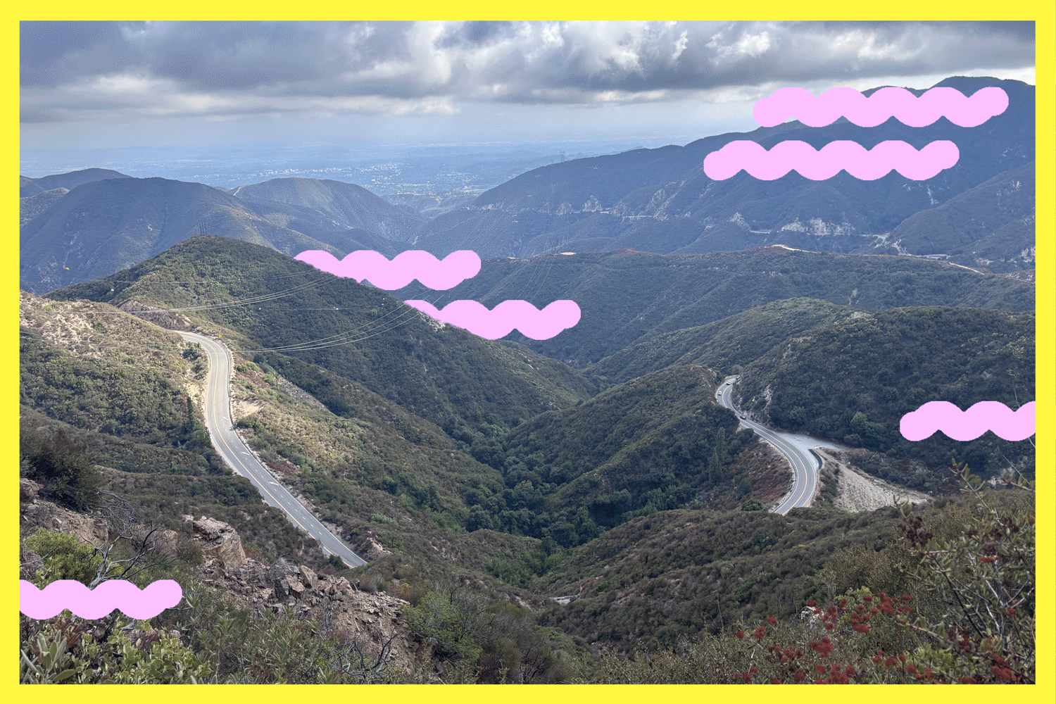
Mount Hoyt is a 4,415-foot mountain in the foremount of the San Gabriel Mountains in the Angeles National Forest. There are multiple ways to get there. I chose to start at Grizzly Flat because it was an easier and shorter route to Mt. Hoyt than other options, such as starting near the Clear Creek Fire Station.
The trail begins via Hoyt Mountain Road, a wide dirt fire road. Notice how the views become more and more beautiful as you climb. We pass lots of buckwheat and other flowering plants popping up from the mountainside.
After about two-thirds of a mile, the road splits. Continue north on Hoyt Mountain Road. After about a third of a mile, you’ll notice that the foliage on the trail becomes thicker. Take a moment to smell the spicy California leaves (my favorite scent in the local landscape). Manzanita, a pachyphyte, may also be seen.
I noticed a lot of animal waste and urine on this trail, including bears. Be aware of nearby mammals. You’ll also notice that you can still hear traffic from the Angeles Crest Highway from the trail, but we think the impressive panoramic views will make up for it.
After about 2.9 miles, you reach a wide, flat area where someone more observant than this outdoor journalist might notice three trails. There is also a road that leads to a power transmission tower, but this reporter may have taken that path before realizing he was on the wrong path. There is also a wider path, the Telephone Trail. If you’re planning a hike to Mt. Hoyt, you may want to take the goat trails between these routes.
This narrow, steep path is a firebreak and is not an “official” trail. The steepness reminded me of the scramble from Brand Park to . You’ll need hiking poles and good traction shoes to find what’s available on the steep hillsides.
There are multiple false summits before reaching Mount Hoyt. You have options — as controversial That might suggest just enjoying one of them. If your soul (and legs) move you, head to Mt. Hoyt.
2. Castaic Rock Trail
distance: 2.1 miles to and from
Elevation gained: about 200 feet
Difficulty: Moderately
Are dogs allowed? yes
Accessible alternatives:
Castaic Rock Trail is a 2.1 mile round trip hiking trail near . It leads to a huge rock, known by many names, including Castaic Rock and Rabbit Rock, which is over 60 meters high in some measurements.
Park on the shoulder of Lake Hughes Road and walk up a short, steep dirt path. It quickly flattens out and offers a comfortable stroll among California buckwheat, sagebrush, and other native plants. As you look around, you’ll see panoramic views of Magic Mountain to the southeast and Cobblestone Mountain and Whitaker Peak to the northwest.
The trail winds around to the east side of the rock. There, historically, benches were placed under the shade of holly cherry trees. Snakes and coyotes are common in this area, so keep your eyes peeled.
3. Briar Summit Open Space Preserve
distance: Approximately 1 mile going and returning
Elevation gained: about 250 feet
Difficulty: Medium easier
Are dogs allowed? yes
Accessible alternatives:
Briar Summit Open Space Preserve is a 52-acre park north of Laurel Canyon that is filled with native plants such as bay sumac. This preserve offers incredible panoramic views of Los Angeles County all to yourself (especially if you go on a weekday).
The hike is easy. Please read the signs, be respectful to residents, and park in the neighborhood near the entrance. Once through the gate, follow a short, steep paved path until you reach a locked gate. Immediately, you have views of downtown Los Angeles to the southeast, the Griffith Park Observatory to the east, and multiple mountain ranges in basically every direction.
Briar Summit escaped the brink of development just over 20 years ago thanks to private donations and public funding. According to a 2004 report, “Continued development on any of the five statutory parcels of this land could result in the extinction of all medium- and large-sized mammals in the range between Cahuenga Pass and Laurel Valley.”
Just a third of a mile away there is a great lookout point where you can sit on a rock and admire the surrounding city. From here, you’ll notice a dirt road heading south. It’s okay for short distances, but you’ll soon be heading down a dusty, unstable slope. We do not recommend using it downhill unless you are ready for intense off-trail training. There are several unofficial “goat trails” or spurs within the reserve that lead in different directions. These are not regularly maintained and should be followed with care.
We hope you have a five-star time wherever you go, whatever that means to you.
3 things to do
1. Celebrate Indigenous Peoples Day around LA
Several Indigenous Peoples Day celebrations are held in Los Angeles County through mid-October. The 5th Annual Tujunga Indigenous Peoples Day will be held Sunday from 11:30 a.m. to 4:30 p.m. at 12400 Big Tujunga Canyon Road in Tujunga. This event will include live music, dance, storytelling, and hands-on workshops. The Vasquez Rocks Natural Area, the ancestral village of Mapipinga, will host a fireside gathering and celebration on Sunday from 3 to 7 p.m. Visitors can listen to live music and stories around the campfire. San Dimas Canyon Nature Center will co-sponsor with Gabrieleno/Tongva of the San Gabriel Band of Mission Indians. There will be a tribal history and native seed planting event Wednesday from 5-7 p.m., and a tribal history and necklace-making workshop Oct. 17 from 5-7 p.m. Stoneview Nature Center will host a celebration with the Gabriel Band of Mission Indians of the Pheasant Nation on Oct. 18 from noon to 3 p.m. Nature walks and drum circles. For more information, please visit our Instagram page linked above.
2. Plant seeds in LA’s Ascot Hills
The Ascot Hills Park Green Team will be holding their monthly restoration event on Saturdays from 8am to 10.30am. Volunteers should meet at the park nursery at the west end of the gravel parking lot. This work includes collecting and sowing seeds of California buckwheat and other native plants. For more information, please see the group.
3. Grow oak trees in Topanga
The Santa Monica Mountains Resource Conservation District needs volunteers to help restore the native oak forest at Trippett Ranch on Saturday from 9 a.m. to noon. Volunteers will water the trees, pull weeds, and apply mulch, as well as potentially planting new acorns if needed. Learn more and register.
Must read
Wild horses grazing in the Mono Lake region have sparked intense debate among environmentalists, indigenous leaders, animal rights activists and governments over how best to manage the herds without destroying the land. “This year, the U.S. Forest Service and Bureau of Land Management approved a plan to round up and remove hundreds of wild horses roaming beyond roughly 200,000 designated acres along the California-Nevada border,” said Times staff writer Laila Seidman. “No date has been set, but it could be as early as this fall.” Environmentalists say the move is necessary to protect Mono Lake’s otherworldly landscape, but local tribes and nonprofit groups say the government’s method of hiring contractors with helicopters to drive horses into stables is dangerous, even deadly, for horses. “They’re going to hunt them down with helicopters and genocide them just like they ran us over,” said Lana Sauluk, vice chair of the Utuutu Gwaitu Paiute Nation, through tears.
This is another debate happening around California about the best use and management plans for public lands.
Have a fun adventure
P.S.
Want to help scientists understand local wildlife? You can do just that by attending , which runs until October. First, download the Citizen Scientist app on your smartphone. Next, go outside and see what plants and animals are in your neighborhood. Be careful and pay attention to the types. Once you’re done taking photos, upload your findings to LA Nature Quest 2025 on iNaturalist. Thank you for helping us protect our native species.
For more information about Southern California’s beaches, trails, and parks, see: . To view this newsletter in your browser, .